
Commercial Drone Photography
New build - Piddinghoe by LRAR

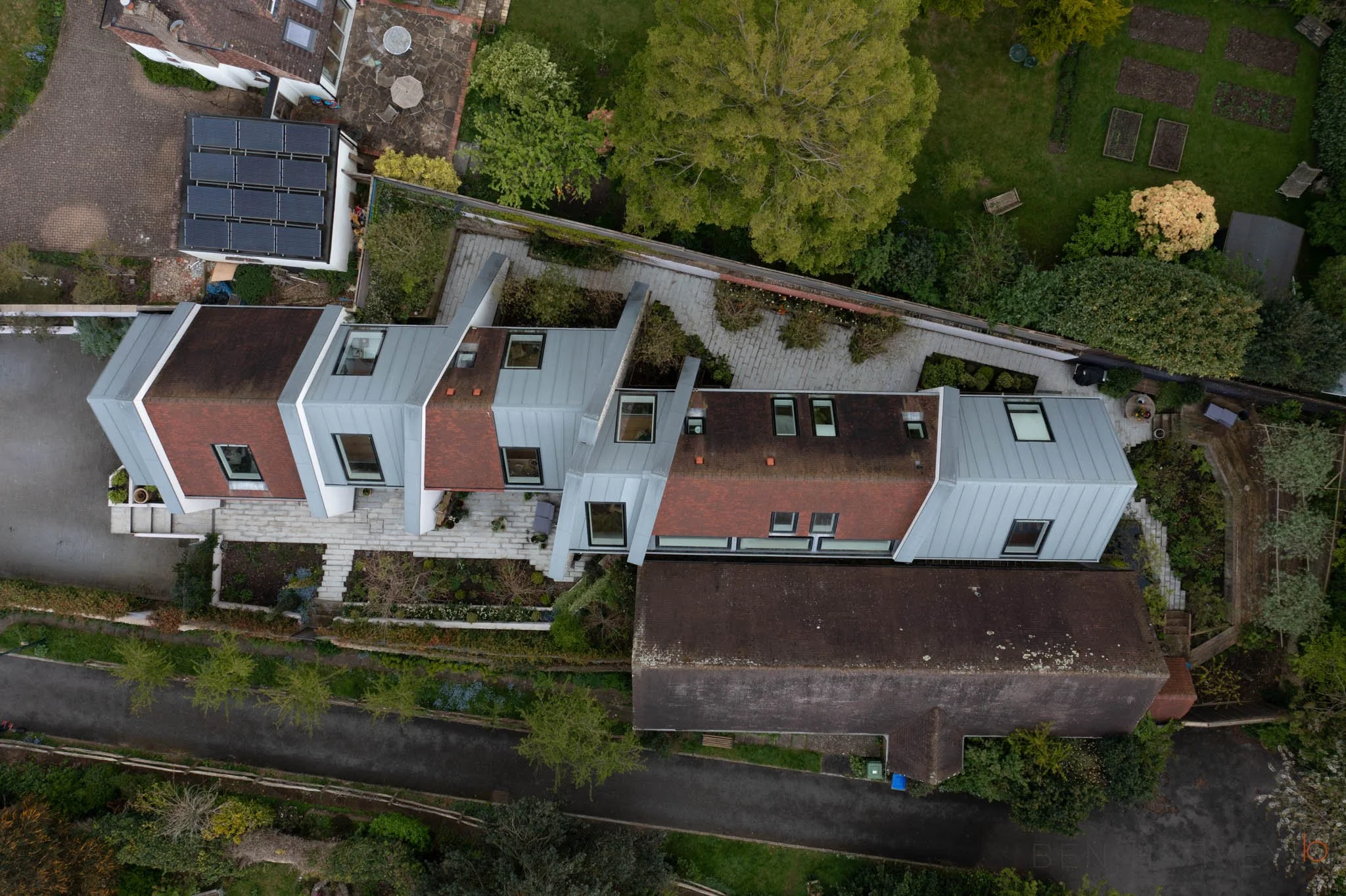
Housing development in Ringmer by LRAR
A camera in the sky!
We live in good times. Creating high quality aerial photographs and video was once a challenge. I have been in a helicopter from Shoreham Airport over Sussex to capture some aerial imagery, and I will still confronted with shooting through the glazing. There may have been an option to remove the door, to get a clear view out, but I don’t like heights as it is! Why risk your life when you can get images from the safety of the ground using a drone?!?
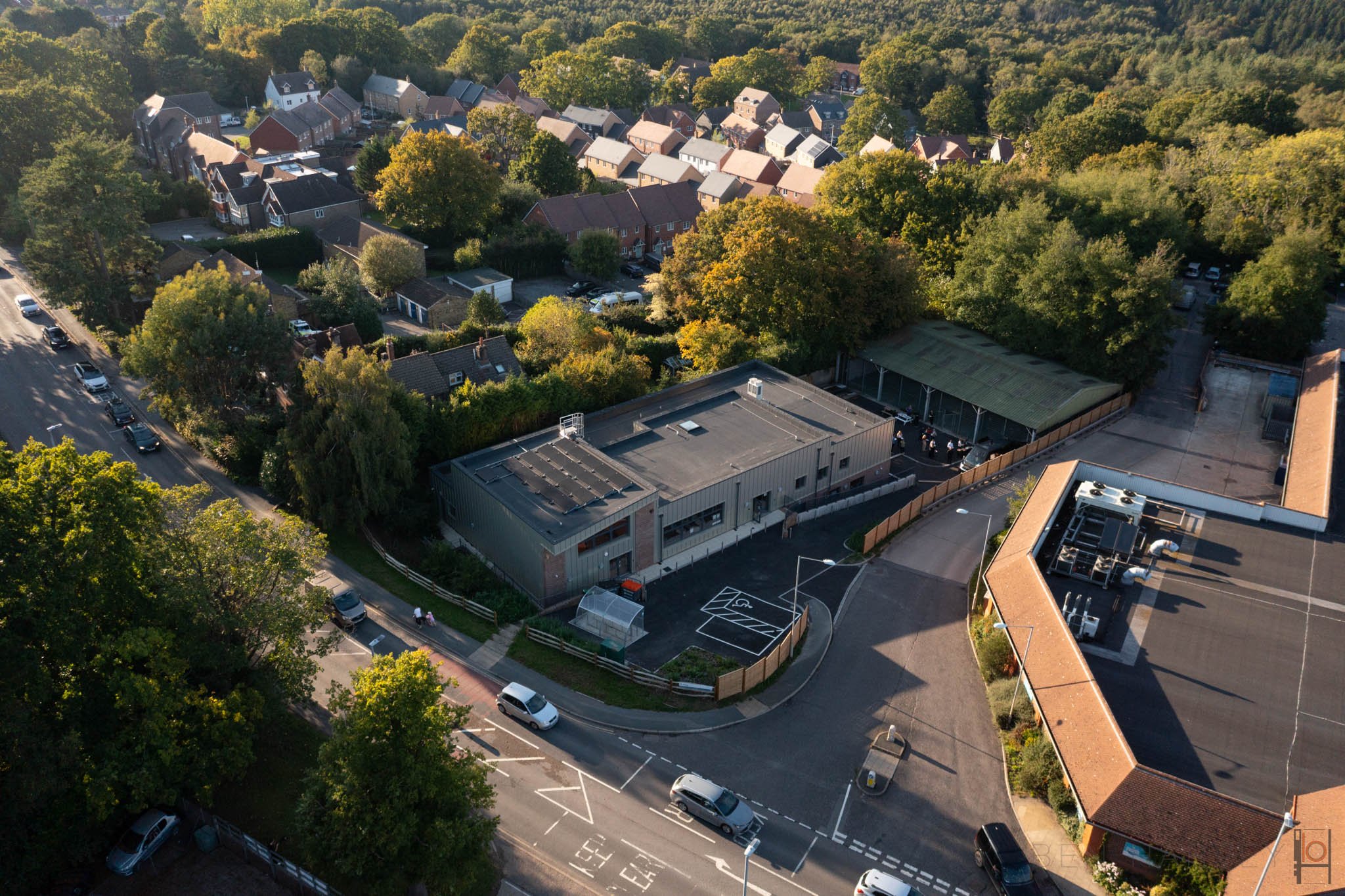
Heathfield Youth Centre by LRAR
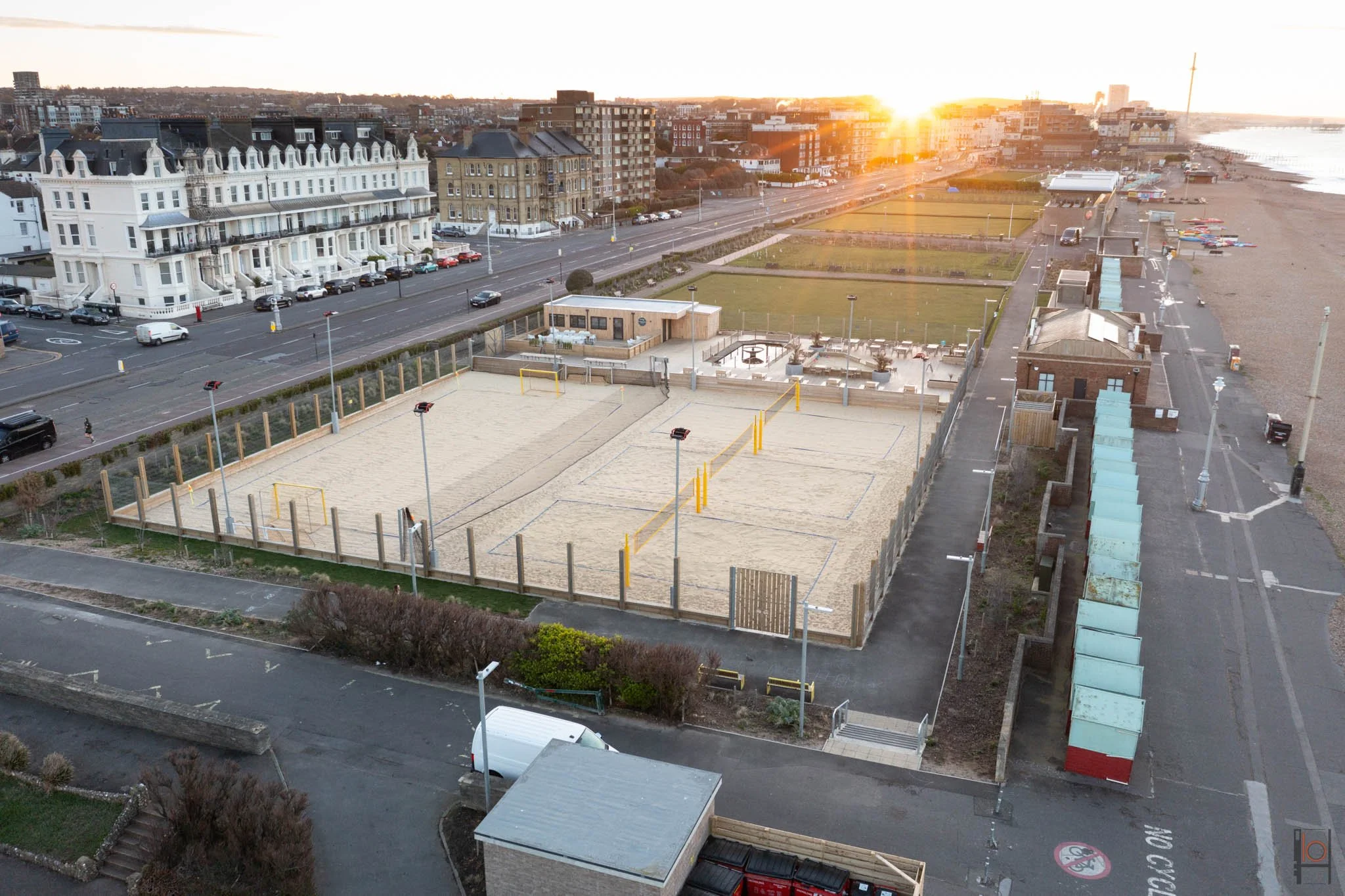
Yellowave Volleyball Arena - by LRAR
Being in the industry
Understanding the process of design, construction and handover of a building is key to working with professionals. As an Architect I am used to being on construction sites, managing health and safety and working around tight construction deadlines. My knowledge of the process makes it easy for coordinating aerial photos, bringing my 15 years of experience to the table to make it streamlined. In most instances, on a commercial instruction, I will combine eye level photography and drone images on the same visit. Not only does this make financial sense, but there is less disruption to the construction team or the occupants if the project has been handed over.
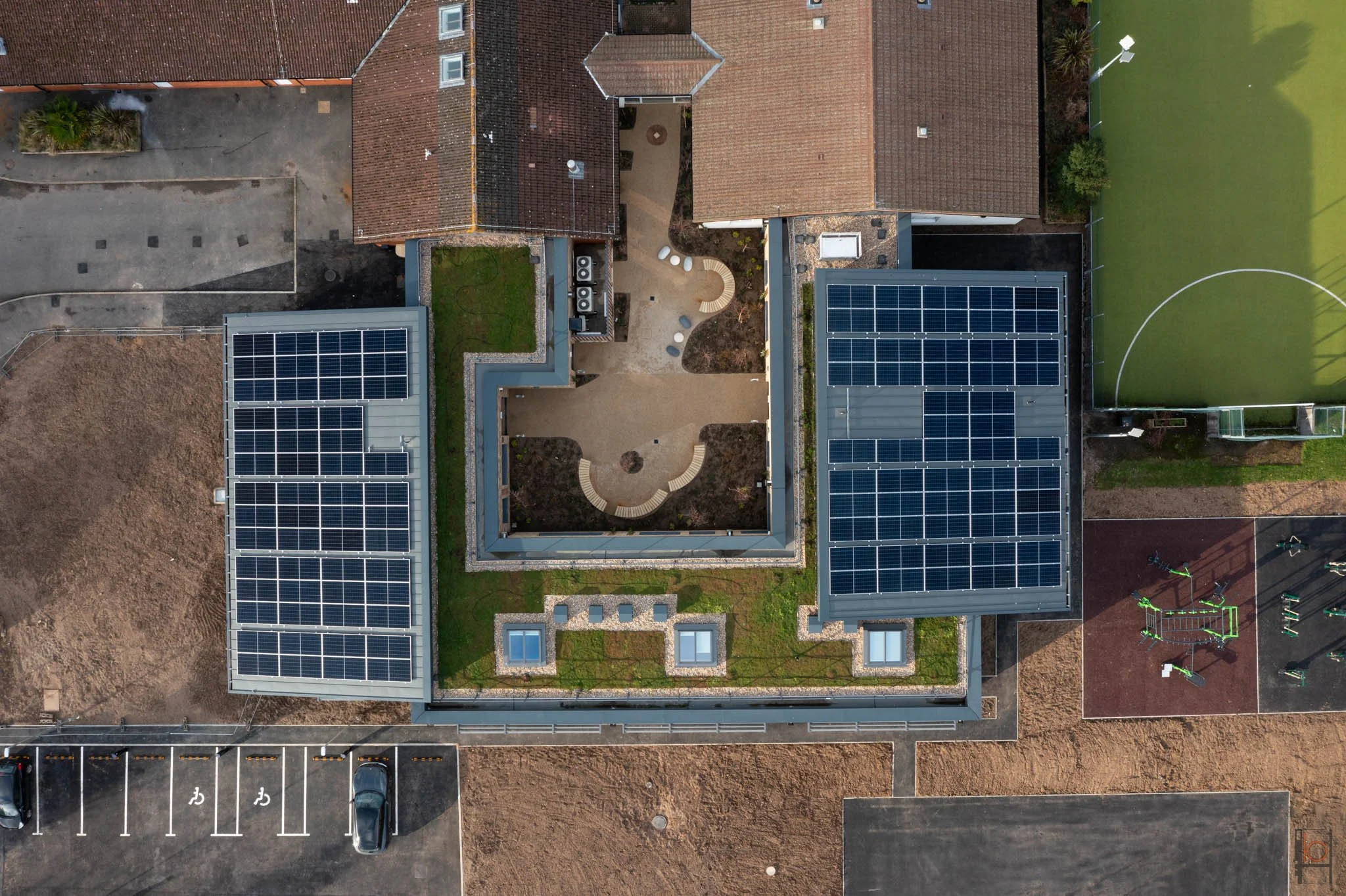
Haybrook College - by LRAR
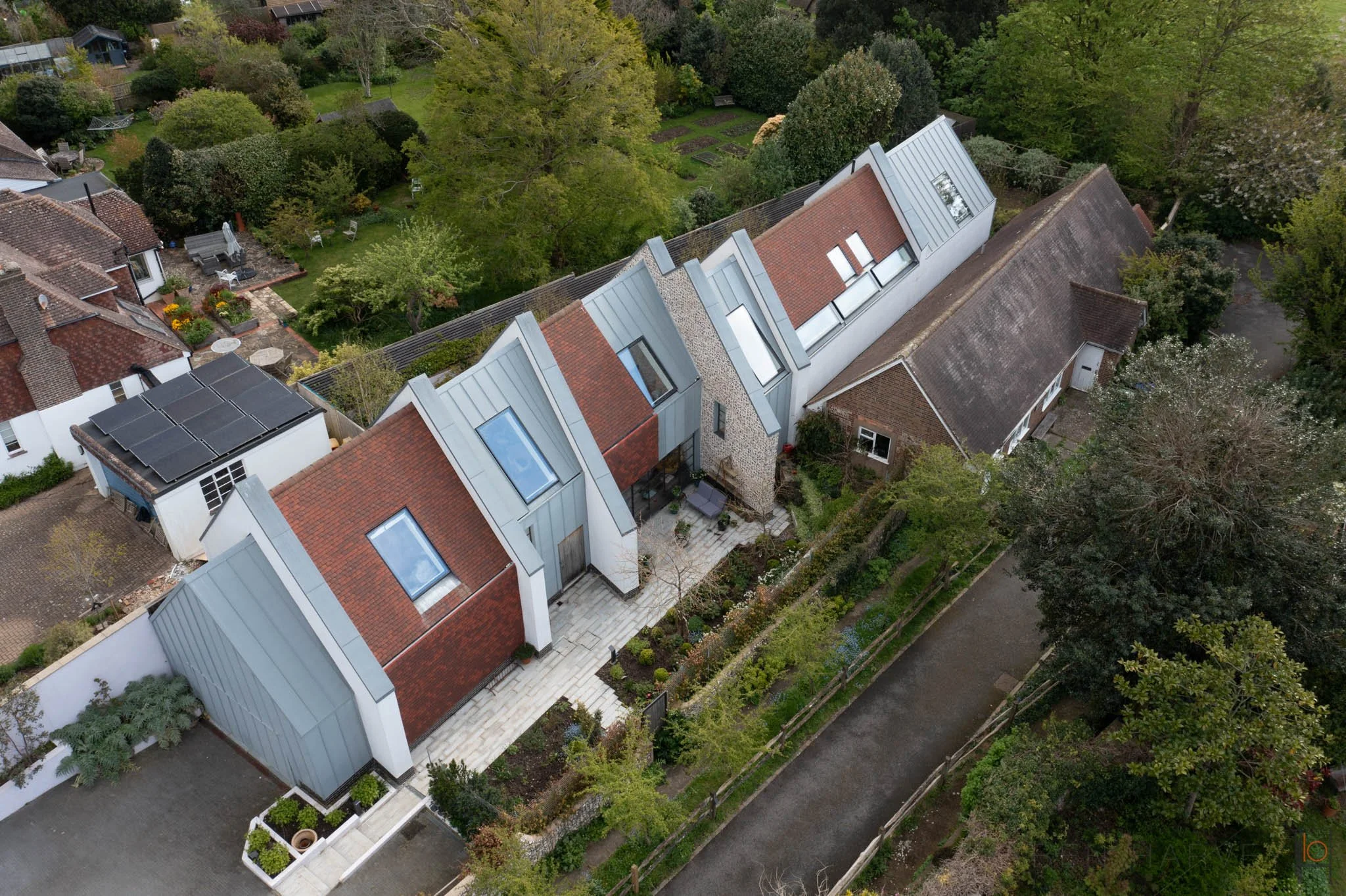
New dwelling by LRAR
Property sales
Aerial imagery, both photos and video, are perfect for helping viewers understand the setting of a property. At ground level there are often obstructions that restrict a clear view of property, and sometimes you can’t get back far enough to show the context of the building. Aerial images are also a helpful way of orienting a property relative to the sun, the road, the beach, the neighbouring properties etc.
If you are an estate agent, or a developer and need high quality aerial images to assist with the sale of your site, then get in touch to discuss your project.
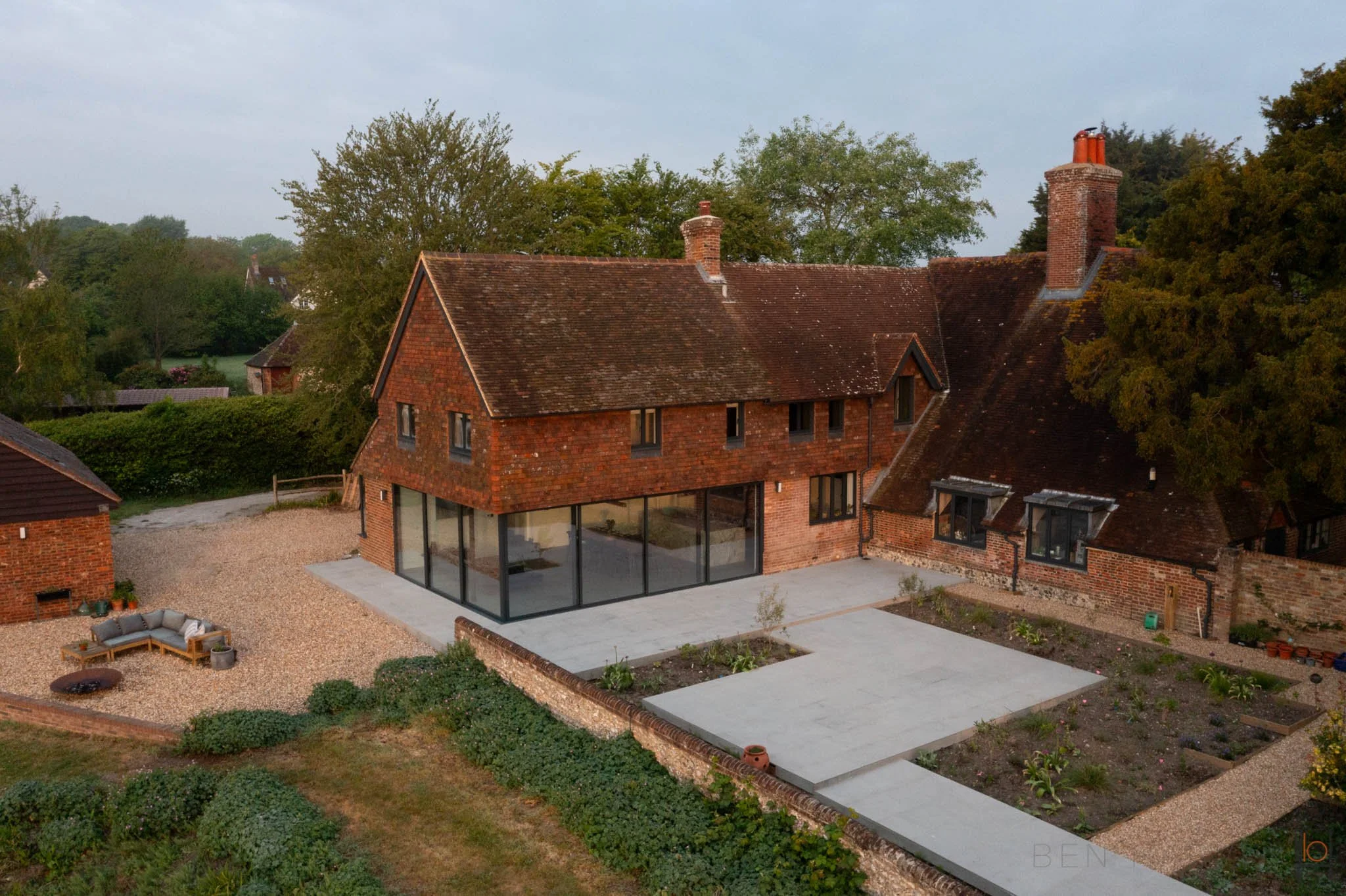
Farmhouse extension by LRAR
Architects and building owners
As a qualified Architect, I can appreciate that not everyone will be able to experience a building in person. Sometimes the photographs are all that we will have to reflect the hard work that goes into designing and procuring a building. Especially if a building is not local or not visible from the public domain. Architects see buildings different to photographers, as we visual them in three dimensions, whereas photographers have the challenge of depicting a volume in two dimensions. I believe I have an advantage over the majority of photographers in this regard, as I experience buildings and architecture from both sides; and I believe that my photographs reflect this.
This article is about aerial photography specifically, and I use drones as a tool to tell the whole storey of development, all the way down to intricate macro details of how materials on a facade interact with one another.
If you would like to see how I can showcase your buildings at their best, then get in touch to discuss your requirements.
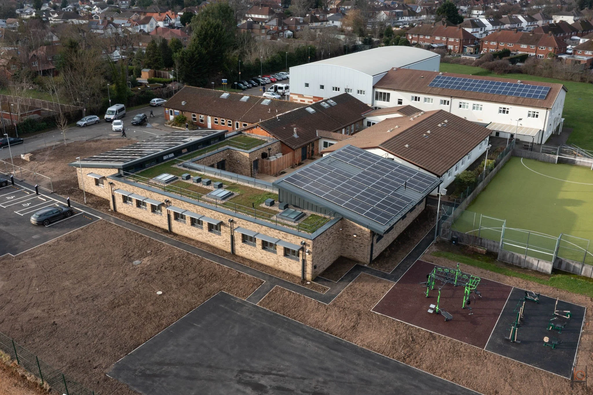
Haybrook College - by LRAR

New housing in Ringmer by LRAR
Contractors and project managers
Progress photographs of a development from demolition, to clearing of the site, foundations, sub-structure through to the external materials is a really helpful way of showing clients the process and excellent for record keeping. Construction methods, such as off site pre-fabricated panels, will dramatically transform a site often within a day or two. Aerial images from before, during and after a timber frame building has been erected is an excellent way of showcasing how quickly a building can come to fruition. Record shots are key for any members of the team who are not site based and are in charge of monitoring the construction programme.
Any slip in the programme can have massive financial consequences, therefore evidence of progress is key for any disputes over progress, aerial images provide an excellent overall view of the construction status.
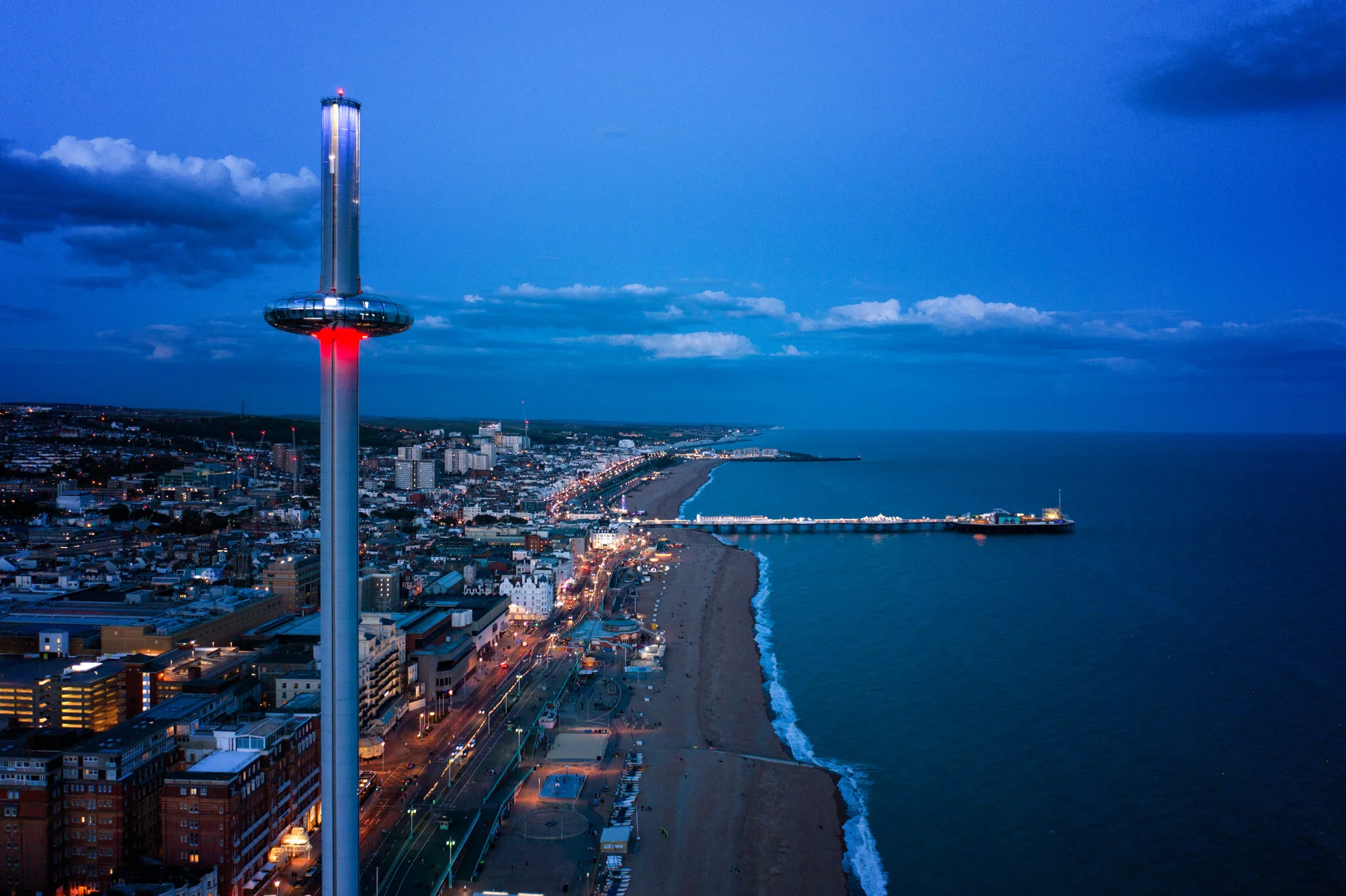
Blue hour shot of Brightons i360
How I am different to other drone photographers
A lot of drone pilots are drone pilots. They are not experts in the construction industry, nor are they excellent photographers. The priority for them has always been piloting a drone. I see a lot of aerial images, used to sell properties or general marketing material, and they are shot at the worst time of day. A professional photographer would research a building’s location, they would photograph it when the lighting is favourable and ensure there are no other distractions such as cars, skips and unfinished elements that would detract away from the main subject. I prioritise the shot, and if that means waiting for the landscaping to establish or returning in a different season to get the better images, then that is what I will do.
I will photograph a property in the best light, even if that means getting up at 4am in June to arrive before the sunrise. This is how I make my work stand out and this is the difference between a photographer with a drone, and a drone pilot who takes photos.

Brighton’s bandstand
Building condition surveys
Having a drone survey is a cost effective way of reviewing building defects, such as roof damage, brickwork pointing or flashing around a chimney. It’s a no-brainer when compared to the cost of scaffolding. There is also a time benefit, as I often carry out the survey and deliver the images within a few working days.
I have written a separate article about the services that I offer for building surveys, which you will find here. If you have a need for a building survey, then send me an email at info@benharveyphotography.co.uk